|
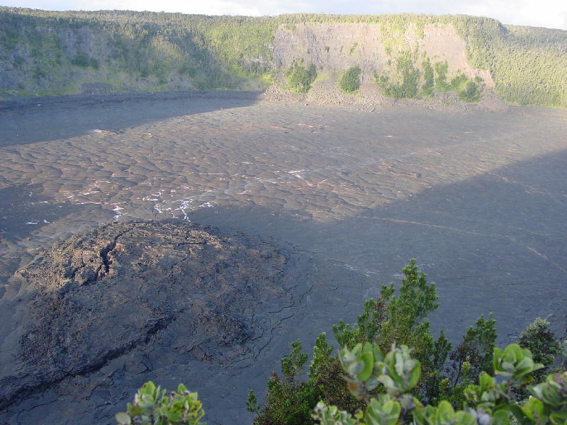
Kilauea Iki ("Little Kilauea") as seen from the Devastation Trail Observatory
You can't really see it but there is a trail that runs from the upper right of the picture to the lower left, right through the middle of the crater. The trail's name is the Kilauea Iki Trail, you guessed it! The crater walls are over 400 feet tall and the trailhead is next to the Thurston Lava Tube (not pictured).
Kilauea Iki's last eruption was in 1959 and it lasted for 36 straight days. During that eruption, it's fountain spurted 1900 feet into the air, the highest in recorded history! That's 500 feet taller than the Empire State Building! In the area pictured here was a pool of lava 380 feet deep! Scientists have been drilling core samples in this particular crater in an effort to study the cooling properties of lava.
|